

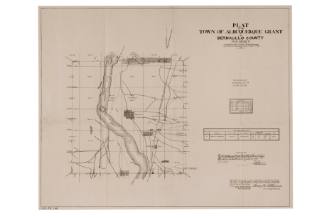
Plat Map of Acoma Pueblo
Manufacturer / MakerCreated by
unidentified
Dateca. 1965
Mediumink on paper
Dimensions38 1/2 × 29 1/4 in. (97.8 × 74.3 cm)
ClassificationsDocumentary Artifact
Credit LineAlbuquerque Museum, History Collection
Object numberPC2022.19.1
DescriptionThis plotted plat map of land use at Acoma Pueblo splits the land into squares and highlights natural and habited areas. National forests, major roads such as Highway (Route) 66, and areas of herded sheep are marked on the map. Certain markings go over the squared borders. Farms are shaded green, sheep herding areas are shaded yellow, and the routes are marked with black lines. Land grants and the specific names of landowners are noted as well as shrine locations and lava flow areas as designated in the legend in the lower left corner.On View
Not on view

United States Government Printing Office
1883
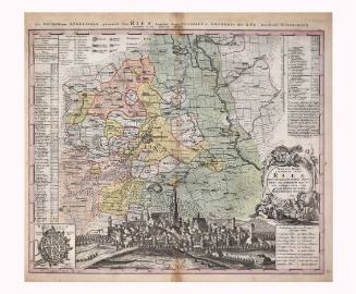


Gio. Ma. Cassini Som. Inc.
1797


Department of the Interior - General Land Office
1907

Department of the Interior Office of Indian Affairs
1934
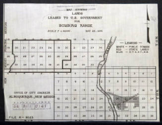
City of Albuquerque - Office Of City Engineer
May 28th, 1941

