

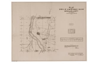
Plat Map of Albuquerque
PublisherPublished by
Albuquerque BluePrint Company
(Albuquerque, New Mexico, active ca. 1937 - ca. 1996)
Date1937
Mediumprinted paper on linen
Dimensions53 x 78 1/2 in. (134.6 x 199.4 cm)
ClassificationsDocumentary Artifact
Credit LineAlbuquerque Museum, gift of Ted Rush
Object numberPC2013.6.1
DescriptionThis map of the City of Albuquerque was printed by Blueprint Company. The map is printed on paper and mounted onto linen with wooden frames (top & bottom) to be rolled up and act as a scroll-type map. Showcasing an aerial view of Albuquerque's buildings from the Rio Grande east to San Pedro Drive, the map has hollowed squares and rectangles indicating clusters of buildings. In a plat map style, many of the buildings are numbered and spaced in sections based on land grants. The Rio Grande runs down the left side of the map and a thin border outlines the square map with designed squares in each corner.On View
Not on view


Department of the Interior Office of Indian Affairs
1934
United States Government Printing Office
1883
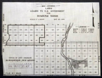
City of Albuquerque - Office Of City Engineer
May 28th, 1941

June 26, 1940


City of Albuquerque - Office Of City Engineer
1916

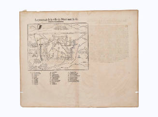
Sebastian Münster
ca. 1568
