

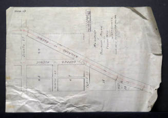
Proposed 18" Storm Sewer Showing Sixth Street Crossing of A.T. and Sante Fe Railway
Manufacturer / MakerCreated by
City of Albuquerque - Office Of City Engineer
Date1944
Mediumink on paper
Dimensions9 × 12 in. (22.9 × 30.5 cm)
ClassificationsDocumentary Artifact
Credit LineAlbuquerque Museum, transfer from the City of Albuquerque Engineer's Office
Object numberPC2017.47.8
DescriptionThis black and white engineer's map shows an example the maps used for city planning. Labeled as a proposed 18 storm sewer at the Sixth Street crossing of Atchison, Topeka & Sante Fe Railway," this map features a detailed account of the coordinates and planned additions to the area around Coolidge Avenue, North Fifth Street, and North Sixth Street. There is a partial compass pointing north on the upper right side and while this and most of the text and numbers are black, straight lines signalling distance are in red. City engineer was H.W. Rankin.On View
Not on view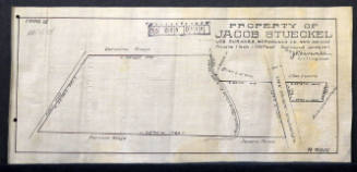
City of Albuquerque - Office Of City Engineer
1912
City of Albuquerque - Office Of City Engineer
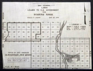
May 28th, 1941


City of Albuquerque - Office Of City Engineer
June 27th, 1912


City of Albuquerque - Office Of City Engineer
1916


Gio. Ma. Cassini Som. Inc.
1797
