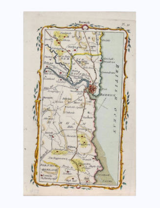
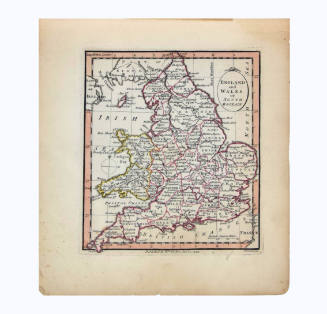
Cockburnspath, Broxburn, Dunbar, Bellhaven, Tyningham Road Map
Artist
Mostyn John Armstrong
(died 1791)
Date1776
Mediumhand colored engraving on paper
Dimensions7 1/4 × 4 1/2 in. (18.4 × 11.4 cm)
ClassificationsDocumentary Artifact
Credit LineAlbuquerque Museum, gift of the Albuquerque Museum Foundation from the Lucia v. B. Batten Estate
Object numberPC2020.51.55
DescriptionThis small hand colored map depicts the road along the coast from Cockburnspath to Tynninghame, England. There is a decorative border around the map that looks like a gold vine with green leaves. At center top, outside the decorative frame, it says, "Dunbar." Near the upper right corner of the map, outside the decorative frame, it says, "Plate 32." In the lower right corner of the map, outside the decorative frame, it says, "J. Barber. fculp." The far right third of the map is the Firth of Forth.On View
Not on view