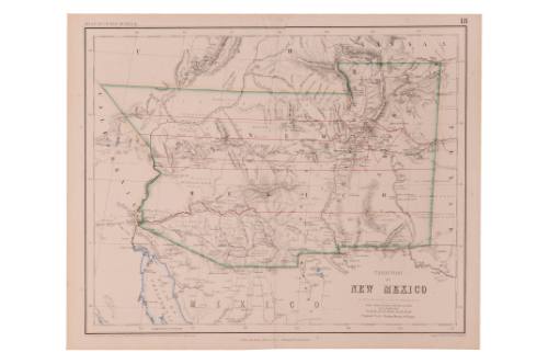
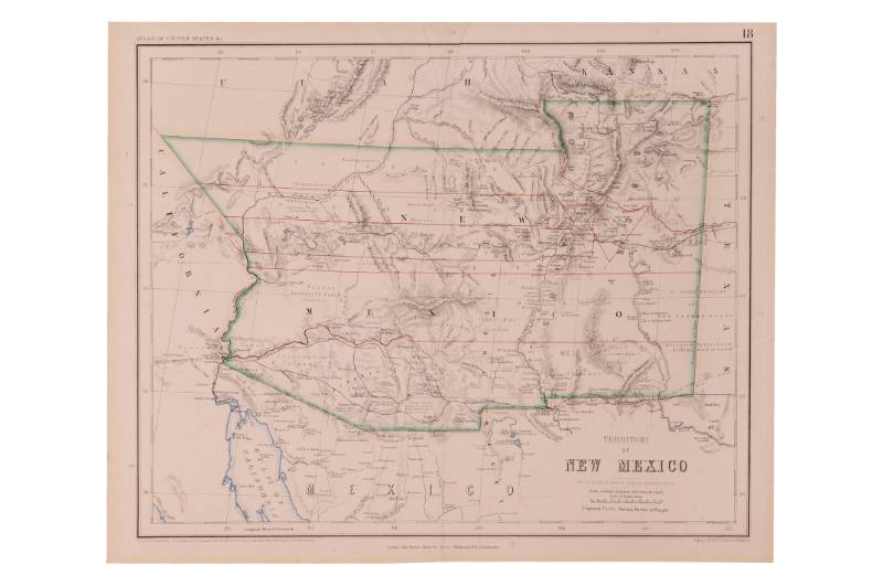
Map of the Territory of New Mexico
Manufacturer / Maker
Rogers & Johnston
Date1857
Mediumink on paper
Dimensions14 × 17 1/2 in. (35.6 × 44.5 cm)
ClassificationsDocumentary Artifact
Credit LineAlbuquerque Museum, museum purchase, 1979 General Obligation Bonds
Object numberPC1982.130.1
DescriptionThis map shows what was perceived at this time to be the borders of New Mexico outlined with green shading, the water bodies in blue, and proposed new routes in purple, and regions in red. The terrain, towns, and waterways are detailed while the borders of Texas, Kansas, Utah, California, and Mexico are also detailed. New Mexico includes what would become Arizona and the title is in the lower right side next to a scale and the manufacturer name. Less than a decade after New Mexico became a U.S. territory, and five years before the Civil War reached Albuquerque, plans were in place to connect America's eastern and western towns with a railway system.On View
Not on viewTerms


Department of the Interior - General Land Office
1907