Skip to main content
Collections
Groups
People
Exhibitions
About
Help
Advanced Search
Works
Close
Refine Results
Artist / Maker / Culture
Mostyn John Armstrong
(3)
Gerard Mercator
(1)
Jans Janssonius
(1)
Matthäus Merian
(1)
Johann Ludwig Gottfried
(1)
Society for the Diffusion of Useful Knowledge
(1)
John Rapkin
(1)
Thomas Conder
(1)
William Hole
(1)
Johannes Blaeu
(1)
Load all
Artist / Maker / Culture
Classification(s)
*
Documentary Artifact
(16)
Prints & Printmaking
(16)
Tourism & Travel
(16)
Tools & Equipment for Science & Technology
(4)
Date
to
Department
History
(16)
Image Available
On View
Sort:
Title (A–Z)
Title (Z–A)
Date (Older First)
Object number (Ascending)
Primary Maker (A-Z)
Last Updated (Ascending)
List
Images
Table
Filters
View PDF
16 results
Tourism & Travel
Prints & Printmaking
Clear All Filters
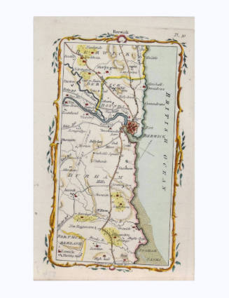
Berwick Road Map
Mostyn John Armstrong
1776
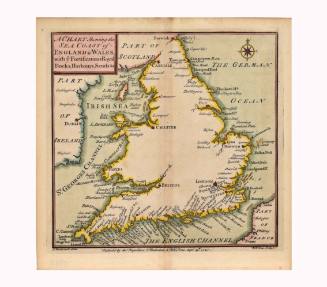
A Chart Showing the Sea Coast of England and Wales, with ye Fortifications, Royal Docks, Harbours, Sands, &c
Thomas Badeslade
1741
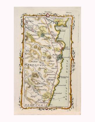
Cockburnspath, Broxburn, Dunbar, Bellhaven, Tyningham Road Map
Mostyn John Armstrong
1776
Image Not Available
for Englalond Anglia Anglosaxonum Heptarchia
Englalond Anglia Anglosaxonum Heptarchia
William Hole
ca. 1607
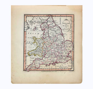
England and Wales or South Britain
William Faden
1798
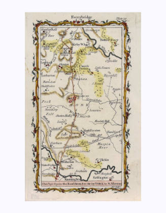
Ferrybridge to Northallerton Road Map
Mostyn John Armstrong
1776
Image Not Available
for Graecia
Graecia
Johannes Blaeu
1640
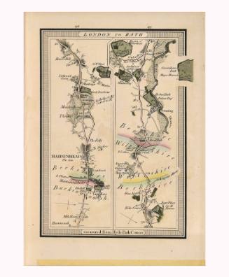
London to Bath
Edward Mogg
1814
Image Not Available
for Malay Archipelago or East India Islands
Malay Archipelago or East India Islands
John Rapkin
1851
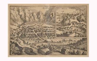
Map of Appenzell and Herissaw
Matthäus Merian
1649
Image Not Available
for Mar Del Zur Hispanis Mare Pacificum
Mar Del Zur Hispanis Mare Pacificum
Jans Janssonius
1650
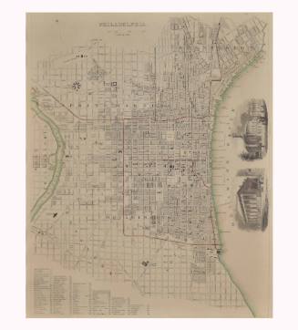
Philadelphia
Society for the Diffusion of Useful Knowledge
1840
Next Page