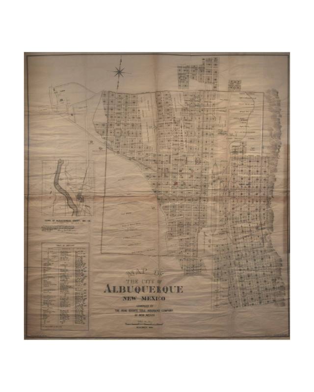
Map Of Albuquerque
Artist
Heliotype Printing Co.
Date1889
Mediumink, paper
Dimensions46 x 43 5/16 in. (116.8 x 110 cm)
ClassificationsDocumentary Artifact
Credit LineAlbuquerque Museum, gift of Peter Gallagher
Terms
Object numberPC1975.44.1
DescriptionA map showing settled and platted neighborhoods east of the Rio Grande River. The neighborhood southeast of the railroad tracks was named after German immigrant Franz Huning, who developed Huning's Highland Addition. Many streets in the Highland Addition are named after Albuquerque citizens. Maps in this period were less about the journeys of the colonial period and became about where settlers were staking claim to land and give insight not only to their naming practices but also who they believed to be prominent figures at the time.On View
On view
United States Government Printing Office
1883
ca. 1956

ca. 1950

Basil K. "Bill" Laskar (April 18, 1921, Chicago, IL - January 13, 2007, Albuquerque, NM)
ca. 1975