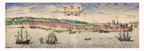
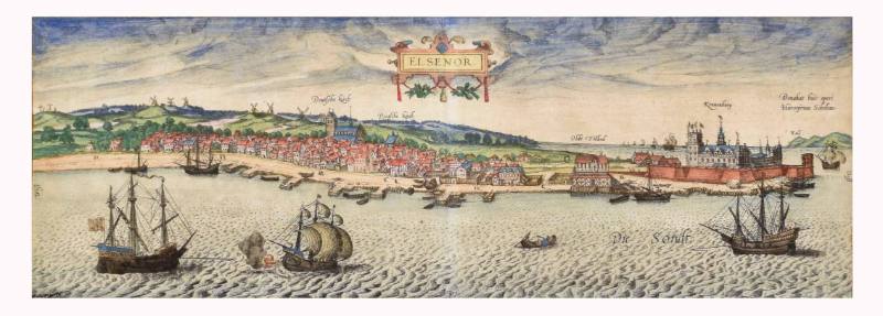
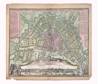
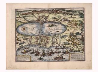
Map of Elsenor
Artist
Georg Braun
(1541 Cologne, Germany - 1622 Cologne, Germany)
Date1580
Mediumcolored engraving on paper
Dimensionsframe: 9 1/2 × 21 3/4 × 1/2 in. (24.1 × 55.2 × 1.3 cm)
ClassificationsDocumentary Artifact
Credit LineAlbuquerque Museum, gift of the Albuquerque Museum Foundation from the Lucia v.B. Batten Estate
Object numberPC2020.51.2
DescriptionThis panoramic illustration of a harbor with several boats and a town in the background. The houses are close together and have red roofs. There are people walking along the harbor. At the top center is written "Elsenor" inside of an ornately drawn frame, and this likely refers to the Danish town of Helsingør. There are windmills on the hill at the left side of the illustration. There are two churches near the center of the town and a palace with a fortress around it on the right end of the harbor. Two ships in the foreground appear to be battling, and there is fire coming from a cannon on one of the ships.This engraving appeared in one of the volumes of Civitates Orbis Terrarum, a series of maps edited by Georg Braun and largely engraved by Franz Hogenberg.
On the left end of the illustration, oriented vertically, it says, "Weft." On the opposite end, oriented vertically, it says, "Ooft." Within the water are the words "Die Sondt." Above the two churches it says, "Deutfche kirch" twice, and above the castle it says, "Kronenburg," which refers to the name of the castle. Above a two-story house along the harbor, it says, "Olde Tolhod." Above a hill in the distance is the word "Koll." Written near the upper right corner, it says, "Donabat huic operi/Hieronÿmus Scholeus."
On View
Not on view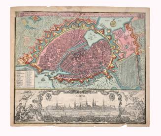
Deb Haaland
August 17, 2018